


today
/
tomorrow
/
day after tomorrow
/
Live & Book
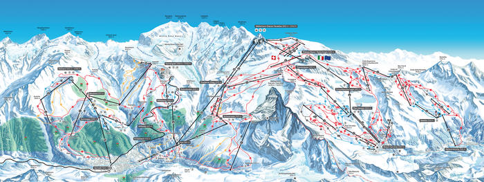
The Matterhorn Ski Paradise stretches from the Rothorn (3,103 m) via Gornergrat (3,089 m) to the Matterhorn Glacier Paradise (3,883 m) and Schwarzsee (2,583 m). There is a connection from Matterhorn Glacier Paradise to Breuil-Cervinia / Valtournenche and Val d’Aosta.
Room / Appartment 1
Room / Appartment 2
Room / Appartment 3
Room / Appartment 4


